Log in
All resources
Create a design
151 Free Artworks of 1641 Maps
engraving
city
cartography
urban landscape
ciudad
chalcography
grabados
paisaje urbano
libros del siglo xvii
fondo antiguo
itinerario (jan huygen van linschoten)
latin-language maps
17th-century maps of catalonia
coats of arms of catalonia
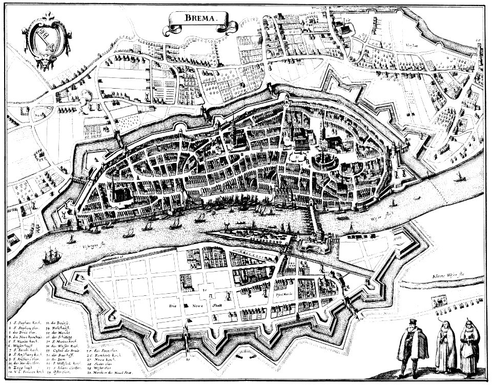
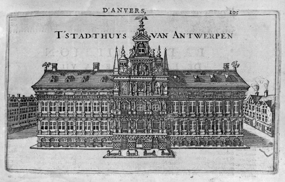
bremen in topographia saxoniae inferioris (merian)
engravings by matthäus merian
engravings by matthäus merian
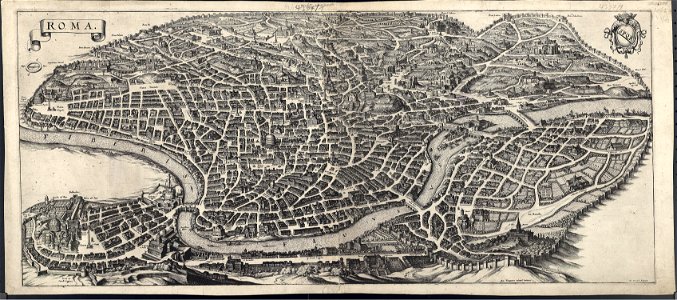
old maps of rome
flandria illustrata
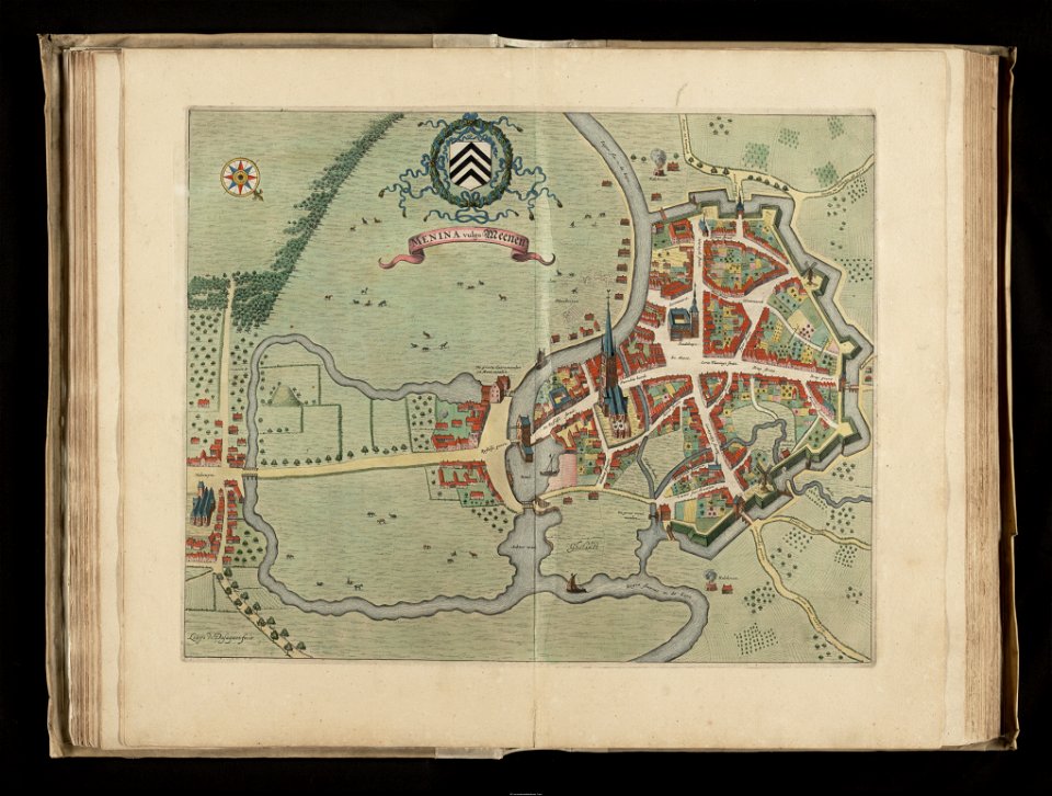
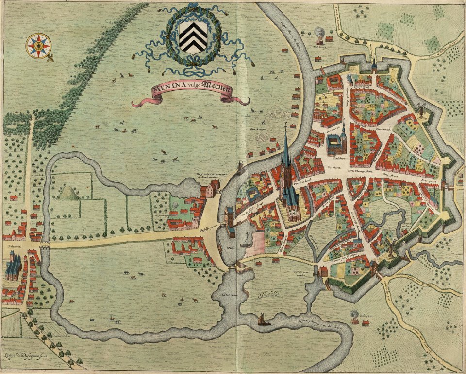
old maps of menen
old maps of oudenaarde
flandria illustrata
flandria illustrata
old maps of menen
flandria illustrata
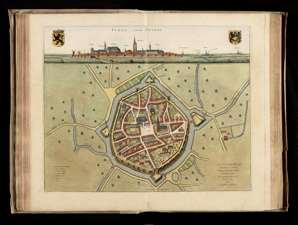
veurne
flandria illustrata
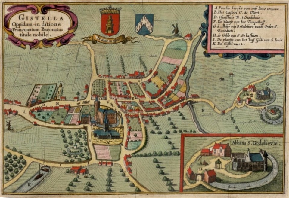
old maps of gistel
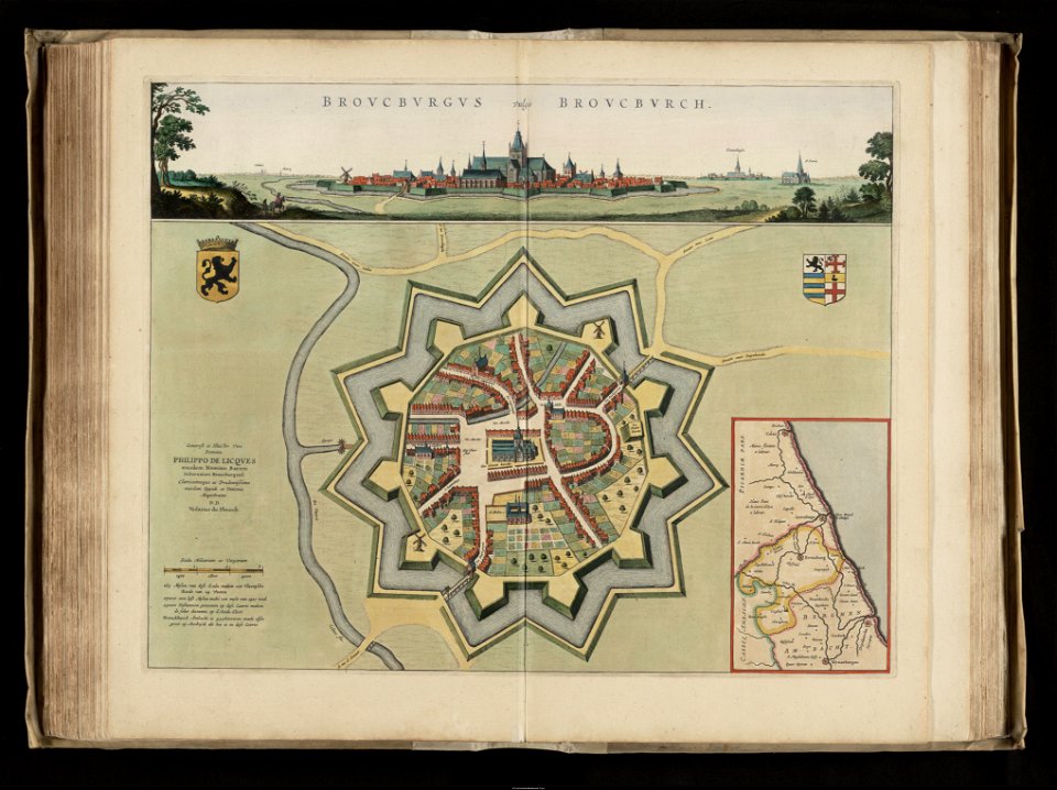
old maps of bourbourg
flandria illustrata
maps by frederick de wit
copper engraving
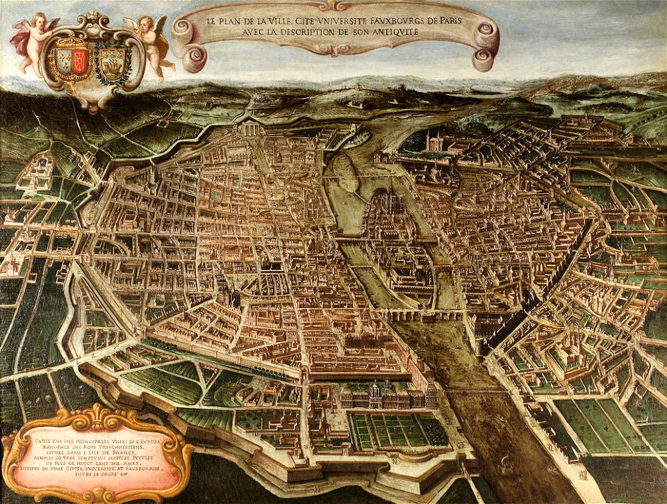
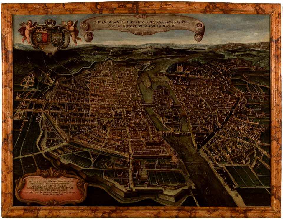
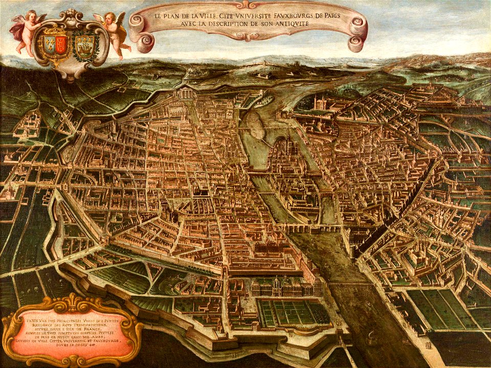
paintings in musée carnavalet
bird's eye view maps of paris
maps of paris from paris musées
paintings in musée carnavalet
maps of paris from paris musées
paintings in musée carnavalet
claes jansz. visscher (ii)
circumvallation
itinerario (jan huygen van linschoten)
latin-language maps
maps by willem and johannes blaeu
copper engravings
flandria illustrata
history of zottegem
maps of aire-sur-la-lys city walls
old maps of aire-sur-la-lys
old maps of gravelines
flandria illustrata
old maps of spanjaardenkasteel
flandria illustrata
history of weißenfels
baroque
maps by hendrik hondius the younger
1640s maps of the world
flandria illustrata
old maps of lille
old maps of blankenberge
flandria illustrata
maps of ghent by hendrik hondius
old maps of spanjaardenkasteel
joan blaeu
kőröshegy
parts of old maps of bremen
baroque
egmontkasteel in art
flandria illustrata
flandria illustrata
antonius sanderus
parts of old maps of bremen
baroque
engravings of castles in belgium
old maps of ypres
pages of books about history
flandria illustrata
flandria illustrata
maps of ninove
flandria illustrata
maps of poperinge
flandria illustrata
old maps of deinze
history of sint-niklaas
flandria illustrata
maps of mitte (bremen)
baroque
maps by hendrik hondius the younger
1641 maps
eran laor cartographic collection
baroque
bremen in topographia saxoniae inferioris (merian)
baroque
eran laor cartographic collection
willem blaeu
dutch 17th-century prints in the rijksmuseum amsterdam
jan van hilten
eran laor cartographic collection
michel van lochom
eran laor cartographic collection
michel van lochom
dutch 17th-century prints in the rijksmuseum amsterdam
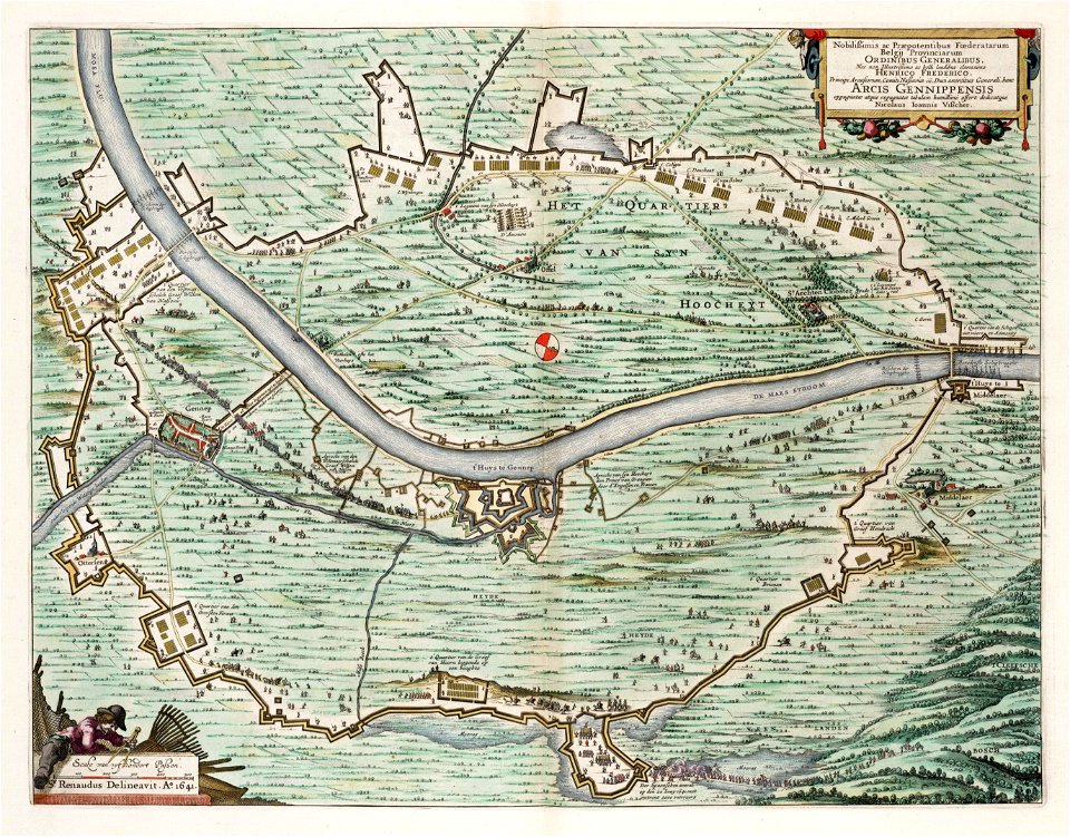
siege of gennep
maps in the library of congress
1713 maps
pieter verbiest (ii)
maps from gallica
prints by claes jansz. visscher (ii) in the rijksmuseum amsterdam
maps in the rijksmuseum amsterdam
maps in the library of congress
1721 maps
prints by claes jansz. visscher (ii) in the rijksmuseum amsterdam
siege of gennep
dutch 17th-century prints in the rijksmuseum amsterdam
siege of gennep
maps
city
maps
city
maps
city
maps
city
maps
city
1640s maps of ireland
baroque
prints by claes jansz. visscher (ii) in the rijksmuseum amsterdam
siege of gennep
prints published by claes jansz. visscher (ii) in the rijksmuseum amsterdam
maps in the rijksmuseum amsterdam
prints published by claes jansz. visscher (ii) in the rijksmuseum amsterdam
maps in the rijksmuseum amsterdam
prints by claes jansz. visscher (ii) in the rijksmuseum amsterdam
maps in the rijksmuseum amsterdam
prints by claes jansz. visscher (ii) in the rijksmuseum amsterdam
siege of gennep
prints by claes jansz. visscher (ii) in the rijksmuseum amsterdam
siege of gennep
dutch 17th-century prints in the rijksmuseum amsterdam
siege of gennep
maps
city
maps
city
maps
city
maps
city
maps
city
maps
city
maps
city
maps
city
maps
city
maps
city
maps
city
maps
city
maps
city
maps
city
maps
city
maps
city
maps
city
maps
city
maps
city
maps
city
maps
city
maps
city
maps
city
siege of gennep
jan van hilten
maps
city
maps
city
maps
city
maps
city
maps
city
maps
city
maps
city
maps
city
maps
city
maps
city
maps
city
1 - 100 of 151
Next page
/ 2